New Maps Show Forests Absorb Twice as Much Carbon as They Release Each Year
Article from World Resources Institute
New methodology, released in Nature Climate Change, provides greater detail into forest carbon fluxes
January 21, 2021 – New globally consistent methods for mapping forest carbon sources and sinks around the world show that forests absorb a net 7.6 billion metric tonnes of carbon dioxide each year. The data confirms that globally forests are an overall carbon sink, though there is variation within forests. The new maps, released today in Nature Climate Change, offer a highly detailed picture of forests’ role in regulating carbon emissions.
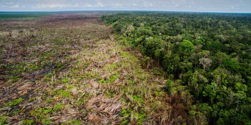
The forest carbon flux map, now publicly available on Global Forest Watch, shows that between 2001 and 2019, forests emitted an average of 8.1 billion metric tonnes of carbon dioxide per year from deforestation and other disturbances. At the same time, forests absorbed 16 billion metric tonnes of carbon dioxide per year. The study highlights the need to invest in both reducing deforestation in tropical countries and maintaining and enhancing forest carbon sequestration at the same time. The continued destruction of the world’s largest tropical forests – 11.9 million hectares of tropical tree cover was lost in 2019 alone – makes them less powerful carbon sinks.
The granularity of these data enables emissions and removals to be quantified more consistently across any geographic scale ranging from small local forests, to countries, to entire continents. For example, the data show that 27% of the world’s net forest carbon sink falls within protected areas, underscoring the need for conservation within these areas.
The methodology was developed by a team of scientists and researchers from CIFOR, NASA Goddard, NASA Jet Propulsion Lab, The Sustainability Consortium, University of Maryland, Wageningen University, Woodwell Climate Research Center and World Resources Institute. By combining ground measurements with satellite observations this method provides the first globally consistent dataset for estimating carbon fluxes from forests. This new monitoring system will support more targeted policies and actions, and transparent tracking towards forest-specific climate mitigation goals with both local detail and global consistency.
QUOTES:
“Forests act as a two-lane highway in the climate system. Standing forests absorb carbon, but clearing forests releases it into the atmosphere. A detailed view of where both sides are occurring – forest emissions and forest removals – adds transparency to monitoring forest-related climate policies.”
– Dr. Nancy Harris, Research Director for Forests Program, World Resources Institute
“With separate accounting of forest emissions and sequestration, we can more clearly see the dual role that forests play in carbon accounting. This model also enhances flexibility – it can be improved as better data become available.”
– David Gibbs, GIS Research Associate for Global Forest Watch, World Resources Institute
“The new maps will be important for the UNFCCC’s first global stocktake in 2023 by better linking and harmonizing national GHG inventories with global IPCC estimates.”
– Dr. Martin Herold, Wageningen University
“We now have a framework that can combine these large satellite derived global datasets into a unified system for forest carbon accounting and potential real world applications. It’s something that we in the forest remote sensing community have been working towards for many years, but was a big scientific and computational challenge until now.”
– Dr. Temilola (Lola) Fatoyinbo is a Research Physical Scientist in the Biospheric Sciences Lab, NASA Goddard Space Flight Center
“We now have eyes everywhere to monitor changes of forest cover and carbon stocks globally. Harnessing these new observations, mostly from NASA and European space agencies, has given the science and policy communities the capability to better design and implement climate mitigation agreements.”
– Dr. Sassan Saatchi, Principal Scientist for Carbon Cycle and Ecosystems, NASA Jet Propulsion Laboratory
“The maps provide a sound basis for developing policies and programs that will sustain and enhance the capacity of global forests to remove carbon dioxide from the atmosphere, even as they are threatened by increasing risks of climate change and natural disturbances.”
– Dr. Richard Birdsey, Senior Scientist, Woodwell Climate Research Center
“Thanks to remote sensing technology it was possible to leverage sparse field measurements with spatially detailed wall-to-wall images, resulting in a better understanding of the carbon storage and fluxes across the Earth’s forested landscapes. In the near future, measurements collected by recent space sensors such as NASA GEDI will have the potential to improve these estimates.”
– Dr. Alessandro Baccini, Research Professor, Boston University Center for Remote Sensing; Senior Scientist, Woodwell Climate Research Center


